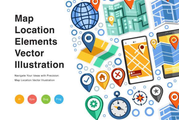
Navigate Your Designs with Map Location Elements
Every visual project tells a story, but sometimes that story needs a specific setting. When your narrative involves geography, travel, or local relevance, you need more than just words. You need visual shorthand that instantly communicates place. The Map Location Elements Vector Illustration provides exactly that. This collection is a toolkit for spatial storytelling, giving designers a rich vocabulary of pins, compasses, topographic lines, and city icons to ground their ideas in a tangible world.
A Toolkit for Spatial Storytelling
This isn't a single, static image. It's a modular system of graphics. Think of it as a visual language for location. You get a variety of elements: classic map pins, detailed compass roses, simplified building silhouettes, winding road lines, and subtle topographic textures. Each piece is crafted with a clean, modern aesthetic. The lines are crisp, the colors are customizable, and the style is consistent across the entire set. This consistency is crucial. It allows you to mix and match elements to build complex scenes or use a single icon for a focused call-to-action, all while maintaining a unified look.
The personality of these illustrations is practical and versatile. They avoid overly playful or cartoonish styles, making them suitable for professional contexts. Yet, they have enough detail to feel engaging and informative. This balance is what makes them so powerful. They serve as excellent design assets that don't distract from your core message but rather enhance and clarify it.
Where Geography Meets Creativity
The applications for this vector set span nearly every creative field. For brand identity and logo design, a single map element can become a cornerstone of a visual system for a travel agency, a local tour company, or a neighborhood cafe. It adds an immediate sense of place and purpose.
In editorial design and publishing, these elements are invaluable. Imagine a magazine feature on hiking trails, where topographic lines and pin markers guide the reader's eye through the article. A cookbook focusing on regional cuisine could use city skyline vectors to chapter its sections. For packaging design, especially for products with geographical origins like coffee, wine, or artisanal goods, a subtle map background or a compass icon can communicate origin and quality without a single word of text.
The digital space is a natural home for this collection. Web design projects benefit enormously. Use a pin marker for a "Contact Us" section, a compass for a "Services" page, or a full illustrated map for an "About Us" page detailing a company's journey. For social media graphics, these elements are perfect for creating engaging posts about local events, store locations, or travel inspiration. They help your content stand out in a fast-scrolling feed by providing immediate, recognizable context.
Building Visual Hierarchy and Engagement
Smart use of these map elements directly influences how your audience perceives and interacts with your design. They are excellent tools for establishing visual hierarchy. A large, detailed compass illustration can anchor a poster, while a small, repeating pin motif can create a pattern that guides the viewer through a brochure layout. This strategic use of modern typography and graphic elements ensures your information is consumed in the order you intend.
From a branding perspective, incorporating consistent geographic motifs strengthens brand perception. It signals that a business is grounded, knowledgeable, and connected to its physical or service area. This builds recognition and trust. A real estate agency using a stylized map of their core neighborhoods in all their materials becomes synonymous with local expertise.
Engagement is driven by relevance. When a viewer sees a map pin on a social media ad for a local event, the connection is instant. The illustration does the cognitive work of saying "this is near you" or "this is a place," making the call-to-action more compelling. It turns abstract information into a concrete invitation.
Practical Guidance for Implementation
Integrating a new set of design assets requires thoughtful evaluation. Start by assessing the project's tone. The clean, versatile style of the Map Location Elements Vector Illustration suits corporate, educational, and consumer projects alike, but always check if its specific line weight and detail level match your overall aesthetic.
Font pairing is a key consideration. These illustrations work well with a wide range of typefaces. For a clean, modern look, pair them with a simple sans serif font. To create contrast and a more classic feel, use them alongside a refined serif font. For projects that need a touch of personality, like a travel blog, they can even complement a subtle script font or handwritten font used for headlines.
Always test readability in context. Place your chosen map element alongside your text and main imagery. Does it add clarity or clutter? Scale it appropriately. A tiny, complex topographic map might become noise in a busy layout, while a bold, simple pin icon can be a perfect, clear signal.
Finally, review the file formats included: EPS, AI, SVG, and PNG. This is a professional-grade package. The vector formats (EPS, AI, SVG) allow for infinite scaling without quality loss, which is essential for large-format print or responsive web design. The PNG files are ready for quick use in digital documents and social media posts. Understanding these formats ensures you can use the assets efficiently across all your projects, from a small business card to a trade show banner.
By treating these map elements not as mere decorations but as functional components of your visual communication, you can create designs that are not only beautiful but also deeply informative and effective. They provide the visual tools to make any location-based concept tangible and engaging for your audience.